Kati Thanda–Lake Eyre fills partially every few years, but a complete fill has only occurred about four times in the past century. Its water arrives via inland river systems, fed by heavy rainfall in Queensland’s Channel Country. Floodwaters surge south through arteries like the Diamantina, Cooper Creek, Georgina, and Warburton rivers.
This year, record-breaking rainfall in southwest Queensland—around March—triggered the lake’s latest transformation. Roughly one million square kilometres were inundated, an area four times the size of the UK. It’s hard to grasp. Between 600 and 1,000 billion litres of water must travel over 1,000 km to reach the Lake Eyre Basin. Why doesn’t it flow out to sea? Because Lake Eyre is Australia’s lowest point. Some sections lie 15 metres below sea level.
Hambidge Point - where the lake never ends and the sky never begins
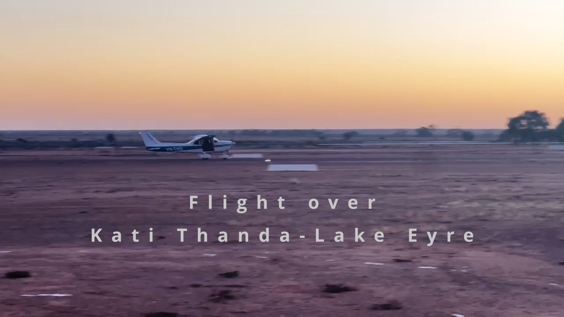
In May, I had the chance to fly over the lake. For the sake of good photography, I chartered a Cessna 172 with no passenger door. We took off from William Creek airstrip just before sunrise. The cold air streaming past the door opening tugged at my jacket. I was prepared: beanie, multiple layers, and heavy boots.
It took about 20 minutes to reach the lake, which gave me time to figure out how to shoot through the open doorway—something I’d never done before. The cockpit wasn’t exactly roomy. There was barely space for both the pilot’s and my elbow between the seats. Strapped in, you couldn’t swivel easily; instead, you twisted your upper body to aim the camera out. A strut just ahead of the door limited the forward view to a triangle barely wide enough for a 35mm shot. The 90-degree angle aspect was framed by the wing and the left wheel. Push the camera out too far, and the airstream shakes it violently.
Kati Thanda-Lake Eyre, SA, Australia
As we reached the lake, the sun rose over the horizon. Colours shifted across the landscape. I forgot the cold and the awkward shooting position—the view was breath-taking. It’s hard to describe. Thankfully, I took a few photos. In some areas, salt and sand formed intricate patterns. In others, vast expanses of water stretched endlessly. The water and sky merged so seamlessly you couldn’t tell where one ended and the other began. Where the water met the shores or islands, it carved out astonishing shapes and textures.
View out of the cockpit on a flight over Kati Thanda-Lake Eyre
I learnt a lot from my first aerial photography flight. Shooting from a small aircraft was challenging. Next time, I’ll opt for the GA-8 Airvan—even though it’s twice the cost. It offers better space for photographers, allowing you to sit sideways and shoot straight out the door. Now that I understand more about the lake, the aircraft, and the results, I’ll collaborate differently with the pilot—requesting specific angles and altitudes.
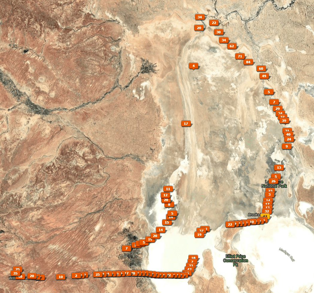
Flight path over Kati Thanda-Lake Eyre, showing the photographs taken
The flight lasted 2 hours, and I took over 2,000 shots. You can not risk coming home with blurry images. There was no turbulense but the awkward shooting position and the difficulty operating the camera made me a little concerned. Better to be on the safe side.
You can see where the shots were taken in the Lightroom map view above.
Ten images made the final cut and are now available for purchase. Click hereto see the collection.
Click the image to see the Kati Thanda-Lake Eyre Photography Collection
See the collection of photographs from the flight here.


Leave a reply